Loading

Thursday, April 14, 2011

Welcome to Republic of Algeria.


Geography
Location: Northern Africa, bordering the Mediterranean Sea, between Morocco and Tunisia.
Area: Total--2,381,740 sq. km. Land--2,381,740 sq. km.; water--0 sq. km. More than three times the size of Texas.
Cities: Capital--Algiers; Oran, Constantine, Annaba.
Terrain: Mostly high plateau and desert; some mountains; narrow, discontinuous coastal plain. Mountainous areas subject to severe earthquakes, mud slides.
Climate: Arid to semiarid; mild, wet winters with hot, dry summers along coast; drier with cold winters and hot summers on high plateau; a hot, dust/sand-laden wind called sirocco is especially common in summer.
Land use: Arable land--3%; permanent crops--0%, permanent pastures--13%; forests and woodland--2%.
People


Nationality: Noun--Algerian(s); adjective--Algerian.
Population (January 2011 official government est.): 36.3.
Annual growth rate (2010 est.): 1.177%. Birth rate (2010 est.)--16.71 births/1,000 population; death rate (2010 est.)--4.66 deaths/1,000 population.
Ethnic groups: Arab-Berber 99%, European less than 1%.
Religions: Sunni Muslim (state religion) 99%, Christian and Jewish 1%.
Languages: Arabic (official), Berber (national language), French.
Education: Literacy (age 15 and over can read and write)--total population 69.9% (2004 est.); female 60.1% (2004 est.); male 79.6%.
Health (2010 est.): Infant mortality rate--26.75 deaths/1,000 live births. Life expectancy at birth--total population 75.26 years; male 72.57 years; female 76.04 years.
Work force (2008): 9.464 million.
Unemployment rate (2010 est.): 30%; Algerian Government estimate 10% in February 2011.
Government
Type: Republic.
Independence: July 5, 1962 (from France).
Constitution: September 8, 1963; revised November 19, 1976, November 3, 1988, February 23, 1989, November 28, 1996, April 10, 2002, and November 12, 2008.
Legal system: Based on French and Islamic law; judicial review of legislative acts in ad hoc Constitutional Council composed of various public officials, including several Supreme Court justices; Algeria has not accepted compulsory International Court of Justice (ICJ) jurisdiction.
Administrative divisions: 48 provinces (wilayat; singular, wilaya).
Suffrage: 18 years of age; universal.
National holiday: Independence Day, July 5, 1962; Revolution Day, November 1, 1954.
Major parties represented in parliament: National Liberation Front (FLN), National Democratic Rally (RND), Movement of Society for Peace (MSP), Workers' Party (PT), Algerian National Front (FNA), Movement for National Reform (MRN), Islamic Renaissance Movement (MNI), Party of Algerian Renewal (PRA), Movement of National Understanding (MEN).
Economy
GDP (2010): $159.7 billion.
GDP growth rate (2010 est.): 4.1%.
Per capita GDP (2010 est.): $4,470.
Agriculture: Products--wheat, barley, oats, grapes, olives, citrus, fruits; sheep, cattle.
Industry: Types--petroleum, natural gas, light industries, mining, electrical, petrochemical, food processing, pharmaceuticals, cement, seawater desalination.
Sector information as % GDP (2010 est.): Agriculture 8.3%, services 30.2%, industry 61.5%.
Monetary unit: Algerian dinar.
Inflation (2010 est.): 5.7%.
Trade: Exports (2010)--$56.7 billion: petroleum, natural gas, and petroleum products 97.58%. Partners (First six months of 2010 est.)--U.S. 22.67%, Italy 13.78%, Spain 10.80%, France 8.83%, Netherlands 5.67%, Canada 5.07%. Imports (2010)--$40.2 billion: capital goods, food and beverages, consumer goods. Partners (First six months of 2010)--France 16.57%, China 11.83%, Italy 9.06%, Germany 6.47%, Spain 5.88%, U.S. 5.88%.
Budget (2011): Revenues--$41.56 billion, expenditures--$47.69 billion.
Debt (external, January 1, 2010): $ 486 million.
U.S. economic assistance (2010 est.): $2.61 million (Development Assistance (DA); International Military Education and Training (IMET); Nonproliferation, Anti-Terrorism, Demining and Related Programs (NADR)).
DEFENSE
Algeria's armed forces, known collectively as the People's National Army (ANP), total 138,000 active members, with some 100,000 reservists. The president serves as Minister of National Defense. Military forces are supplemented by a 60,000-member national gendarmerie, under the control of the president; a rural police force, “communal guard corps,” under the authority of provincial governors (who answer to the Ministry of Interior); and a 30,000-member Sureté Nationale or Metropolitan Police force under the Ministry of Interior.

Algeria is a leading military power in the region and has demonstrated success in its struggle against terrorism. The Algerian military, having fought a decade-long insurgency, has increased expenditures in an effort to modernize and return to a more traditional defense role.

Due to historical difficulties in acquiring U.S. military equipment, Algeria's primary military supplier has traditionally been Russia and, to a lesser extent, China; in 2007 and 2008, Algeria made large purchases of advanced weaponry from Russia. In recent years, however, Algeria has begun to diversify its supplies of military equipment to include U.S.-made ISR aircraft and ground radars purchased through direct commercial sales.

FOREIGN RELATIONS
Algeria has traditionally practiced an activist foreign policy and, in the 1960s and 1970s, was noted for its support of Third World policies and independence movements. Algerian diplomacy was instrumental in obtaining the release of U.S. hostages from Iran in 1981. Since his first election in 1999, President Bouteflika worked to restore Algeria's international reputation, traveling extensively throughout the world. In July 2001, he became the first Algerian President to visit the White House in 16 years. He has made official visits to France, South Africa, Italy, Spain, Germany, China, Japan, Portugal, Russia, the United Kingdom, and Latin American countries, among others, since his inauguration.

Algeria has taken the lead in working on issues related to the African continent. Host of the Organization of African Unity (OAU) Conference in 2000, Algeria also was key in bringing Ethiopia and Eritrea to the peace table in 2000. In 2001, the 37th summit of the OAU formally adopted the New Partnership for Africa's Development (NEPAD) to address the challenges facing the continent. In 2006, Algeria negotiated the Algiers Accords between the Malian Government and Tuareg rebel groups and has continued to play an active role in seeking resolution to that conflict. In August 2009, Algeria initiated a regional counter terrorism approach with Mali, Niger, and Mauritania, seeking to increase security cooperation and address the root causes of instability in the region. In recent months, Algerians also campaigned publicly for strengthening the international legal regime against ransom payment for terrorist kidnappings, including the call for a UN-sponsored resolution condemning such payments.

Since 1976, Algeria has supported the Polisario Front, which claims to represent the indigenous population of Western Sahara. A staunch defender of the Sahrawi right to self-determination under the UN Charter, Algeria has provided the Polisario with support and sanctuary in refugee camps in the southwestern Algerian province of Tindouf. UN involvement in the Western Sahara includes MINURSO, a peacekeeping force, UNHCR, which handles refugee assistance and resettlement, and the World Food Program (WFP). Active diplomatic efforts to resolve the dispute under the auspices of the United Nations Secretary General are ongoing.

Algeria's support of self-determination for the Sahrawi is in opposition to Morocco's claim of sovereignty over Western Sahara. The dispute remains a major obstacle to bilateral and regional cooperation. Although the land border between Morocco and Algeria was closed in the wake of a 1994 terrorist attack in Marrakech, Morocco lifted visa requirements for Algerians in July 2004. Algeria reciprocated by lifting visa requirements for Moroccans on April 2, 2005. Algeria has friendly relations with its neighbors Tunisia and Libya, and with its sub-Saharan neighbors, Mali and Niger. It closely monitors developments in the Middle East and has been a strong proponent of the rights of the Palestinian people, as well as a supporter of Iraq's democratic transition.

Algeria has diplomatic relations with more than 100 foreign countries, and over 90 countries maintain diplomatic representation in Algiers. Algeria held a non permanent, rotating seat on the UN Security Council from January 2004 to December 2005. Algeria hosted 13 Arab leaders at the Arab League Summit, March 22-23, 2005.
Eco tourism - Making the Most of Algeria's Natural Beauty.
n Algeria, as with countries worldwide, Eco tourism is an industry focused on tourism in the natural areas of the country. It both conserves the environment as well as sustains the livelihood of Algeria’s local people. Due to the expansive landscape and its great biodiversity, Eco tourism in Algeria is ideal. Large areas of Algeria have been declared protected areas and an extensive network of National Parks has been established. Without a doubt, Algeria's Eco tourism adventures are not to be missed.

Many tour operators in Algeria offer exciting Eco tourism opportunities. From exploring Algeria's beautiful Mediterranean coastline to venturing into the Saharan Atlas mountains, the options are endless. When selecting a tour operator, ensure that they stick to the high standards of Eco tourism. Such companies must promote good ecological practices, contribute to the preservation of natural areas and make use of local services - thus supporting development of the population. Eco-tour guides will be able to provide you with interesting information on the ecosystems, natural rock formations and wildlife of Algeria.

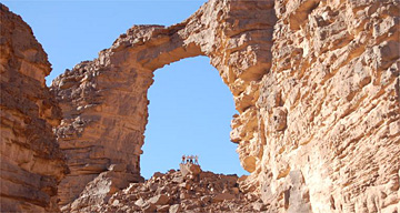
One of the most popular locations for Eco tourism in Algeria is Tassili n'Ajjer National Park, located in southeast Algeria. The park includes a large section of the Tassili n' Ajjer mountain range. The sandstone composition of the mountains has resulted in the formation of amazing rock arches as well as contributing to the growth of woodlands in the park. Due to Tassili n'Ajjer's biological and archaeological significance, the National Park has been designated as a UNESCO World Heritage Site.

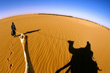
Adventure Eco tourism in Algeria includes trekking, traveling by camel and horseback riding. All of these activities will not only acquaint you with the wonderful natural scenery of Algeria, but also the isolated communities scattered throughout the country.


If you are planning a vacation in Algeria, be sure to get in contact with an eco tourism company so that you can experience Algeria's wild side. Eco tourism in Algeria is a never to be forgotten adventure.
Algerian Art Galleries - Displaying a Wealth of Creative Talent.
There are a number of art galleries in Algeria that are well worth visiting as they provide insight into the culture and lives of the people who call this fascinating North African country home. Some art galleries focus on contemporary art whilst others might be more appropriately termed "museums" as they display artworks from bygone days. Algerian artwork may take the form of sculpture, graphic works, painting or craftwork, with superb examples being found in markets or galleries across the country. There is a large concentration of art galleries located in Algiers, the capital city of Algeria.

Algerians have always displayed artistic talent in their rendering of images, famous persons and their coin inscriptions. In older artworks, the beautiful script of the Arabic language is prominently featured. At times certain religious icons may have been drawn on for inspiration but, in general, artwork tends towards geometric shapes or takes on the likeness of very real people. There are a great many number of busts, printed art and fine art masterpieces on display in the country. Ancient sculptures and antiquities recovered from tombs can also be considered to be great Algerian artworks.

So if you're looking for an alternative to the hustle and bustle of the city or market places, why not visit an art gallery? The National Gallery of Fine Arts displays an impressive array of brilliant masterpieces from around the world and includes the likes of Delacroix and Renoir. However it also has an excellent display of local artists and you will find works by Racim, Temmam and Yelles exhibited in all their power and beauty. The Bardo National Museum features much older artworks and treasures rescued from the soil, while the National Museum of Arts and Popular Traditions certainly has no shortage of stunning artworks. If you're looking for a gallery outside of Algiers, try the Cirta National Museum of Constantine - definitely a gallery that shouldn't be missed. Don't miss out on a visit to the many art galleries of Algeria when you next visit the country!
Climb or Hike the Majestic Mountains of Algeria.


From the Mediterranean coast the landscape peaks in the Atlas Mountains before it stretches across the Sahara Desert. With such varied topography, Algeria's landscape is diverse and fascinating. Algeria's mountain ranges cover large portions of the land. Some of Algeria's mountains form part of the great Atlas Mountain Range whilst others are located only within the country's borders.

The Atlas Mountains

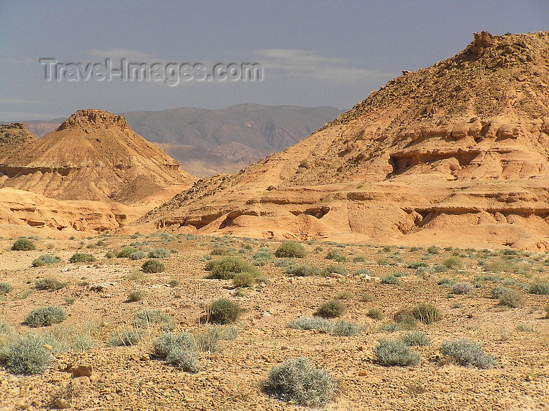
The Atlas Mountain Range extends some 2400km/1500 miles across Tunisia, Algeria and Morocco. It creates a border between the Mediterranean and the Sahara desert and is home to remote Arab villages in Algeria. This impressive mountain range is made up of the following sections: Middle Atlas, Anti-Atlas, High Atlas, Tell Atlas and Saharan Atlas. The latter two ranges are located in Algeria.

The Saharan Atlas


This Algerian Mountain Range makes up the eastern section of the Atlas Mountains. Djebel Aissa is the tallest peak in the Saharan Atlas, reaching 2236 meters in height. Smaller ranges that make up the Saharan Atlas include Ouled-Nael, Amour and Ksour. The Saharan Atlas later meets up with the Tell Atlas, forming the T'bessa and Medjerda ranges. Wadis, such as the Touil, run down from the Saharan Atlas. Wadis are riverbeds that only flow in wet seasons. Chaoui Berbers are the chief residents of this mountain range and they live mainly where the landscape makes agriculture possible.

The Tell Atlas


Measuring some 1500km in length, the Tell Atlas Mountain Range makes its way through Morocco, across Algeria and into Tunisia. The Tell Atlas runs parallel to the Saharan Atlas until it meets in the eastern side of Algeria. Many of Algeria's important cities are located along the Tell Atlas; this includes the capital of Algiers and Oran. The Chelif River runs from the Tell Atlas into the Mediterranean Sea and provides Algeria's inhabitants with a fertile agricultural valley.

The Aures Mountains


This range forms and extension of the Atlas Mountains. It is located in eastern Algeria just to the east of Algeria's Saharan Atlas. Djebel Chelia, also known as Kaltum, is the tallest peak in this range and reaches a height of 2328 m. The Aur's Mountains are very isolated and remain the home of the Shawia people.

The Ahaggar Mountains (aka Hoggar)


Located in the south of Algeria, the Hoggar is a highland area of the central parts of the Sahara. The geography of the region consists mostly of rocky desert. Mount Tahat is the tallest peak of the area, reaching 2918m in height. A common attraction to these Algerian mountains is Assekrem, the place where Le Pere de Foulcault resided in 1905. Due to its less extreme climate, the Hoggar is a region of great biodiversity. The Ahaggar Mountains are the abode of the Imuhagh, who are part of the Tuareg. Nearby is the tomb of Tin Hinan, ancestor and matriarch of the Tuareg people. The Ahaggar region is very popular amongst tourists, with many tour operators visiting the area.

The Tassili n' Ajjer


Lying in the southeast of Algeria, this Saharan mountain range stretches some 500km. The highest point in the Tassili n'Ajjer range is Adrar Afao at 2158 meters. As the mountains are chiefly composed of sandstone, many awe-inspiring natural rock arches have formed. Vegetation in the range is mostly scattered woodland. The range is also popular with tourists because of its archeological interest, which includes the brilliant examples of ancient rock art that are found here. Large portions of the range are protected as part of the Tassili n'Ajjer National park.

Other Mountains and Ranges

Jebel Chenoua, to the west of Algiers, is a mountain group on the coast. Located between Tipaza and Cherchell, Jebel Cheoua is home to Berber speakers. The Gueltara Mountains are in the west of Algeria. The highest point in this small range is 755m high.
National Parks - Conserving Algeria's Diverse Flora and Fauna.


Algeria is a land of great biodiversity. A massive country with a wide variety of landscapes and ecological zones, Algeria has a rich natural heritage. Considered by many to be the most unique natural country of the Mediterranean, Algeria's distinctive morphology, bioclimate, fauna and flora contribute to its great biodiversity. In fact, Algeria is home to some rare species such as the Monk Seal, Barbary red deer, Kabylie Nuthatch and Audouin's Gull. An extensive network of protected areas has been created in Algeria to protect this great natural heritage. Algeria's National Parks encompass a variety of ecosystems, from coastal areas to desert and mountain.

Tassili n'Ajjer National Park in Algeria takes in a large portion of the Tassili n'Ajjer mountain range. Located in the southeast of Algeria, you will discover a variety of natural wonders in this Algerian National Park. The sandstone composition of the mountain range has resulted in a variety of rock arches and other landforms all slowly etched out by erosion. Sandstone has also contributed to the area's ability to sustain large amounts of plant life as it holds water well. Vegetation in the Tassili n'Ajjer National Park is mostly woodland made up of endemic, endangered plant species, namely Saharan Myrtle and Saharan Cypress. Due to the numbers of endangered species along with the great archeological significance of the area, the National Park has been declared a World Heritage Site. The closest town providing access to the park is Djanet.

Below is a list of other protected areas and National Parks in Algeria. Be sure to visit one of these outstanding protected natural areas when touring Algeria.

Coastal National Parks of Algeria:
El Kala National Park
Gouraya National Park
Taza Naional Park

Algerian National Parks of the Mountain Areas:
Theniet El Had National Park
Djurdjura National Park
Chrea National Park
Belezma National Park
Tlemcen National Park

Algerian National Parks of the Steppe:
Djebel Aissa National Park

Algerian National Parks of Sahara:
Tassili National Park
l'Ahaggar National Park

Nature Reserves in Algeria:
la Macta Nature Reserve
Mergueb Nature Reserve
Beni-salah Nature Reserve
Babors Nature Reserve
Iles Habibas Marine Nature Reserve.
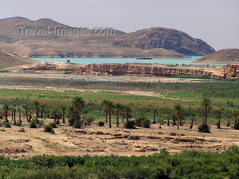
Saharan Algeria Region - Explore the Treasures of the Saharan Desert.


Covering a vast area in the south of Algeria, the Saharan Algeria Region consists of desert terrain as far as the eye can see, with lush oasis towns and villages scattered throughout the region like precious gems in the sand. These settlements are often inhabited by families who have lived there for generations, many with fascinating tales to tell of the extensive history and fascinating culture of the people and of the area. Even the barren landscape between oasis towns has an undeniable beauty which thousands of visitors have come to appreciate.

The magnificent limestone plateau in Saharan Algeria known as the M'zab valley is considered to be of such historic significance that it has been designated as a UNESCO World Heritage Site. Exploring the ancient fortress cities in the M'zab valley is like taking a step back in time where life continues at a pace much different from the world's modern cities. The towns in the M'zab valley include Ghardaïa, Melika At Mlishet, El Guerara, Bounoura At Bunur, Bérianne, Beni Isguen At Isjen and El-Ateuf Tajnint.

Located deep in the Saharan Algeria Region, the city of Tamanrasset is popular with back-packers and campers, providing facilities for budget travelers who enjoy sleeping under the stars, as well as for visitors more accustomed to star-rated hotels. Another UNESCO World Heritage Site located in the Saharan Algeria Region is the Tassili n'Ajjer National Park, which is well worth visiting. The town of Illizi is both the capital of the Illizi Province in the Saharan Algeria Region and one of the gateways to the Tassili n'Ajjer National Park. Illizi offers tourist accommodation and camping sites, making it an ideal base for exploring the surrounding areas. Other towns in Saharan Algeria which are popular tourist destinations include Hassi-Messaoud, Touggourt, Chenachene, Djanet, El Golea, Reggane, Timimoun and Tindouf.

Cuisine of Algeria - A Delicious Blend of Many Cultures.


Algerian cuisine has had many influences that have contributed something unique to the country's culinary delights. Over hundreds of years the Berbers, Arabs, Turks, Romans, the French and the Spanish have influenced the cuisine of Algeria. Each of these civilizations has helped to ensure that Algeria's cuisine is an eclectic mix of flavors, aromas and textures, served in a multitude of ways and very pleasing to the palate.

The Berber influence on Algerian cuisine is clearly seen in their use of stews, lamb, vegetables, grains and dried fruits. The Turks and Arabs have added spice to the mix as well as a variety of delicious pastries. French cuisine has contributed greatly to Algerian dishes with the use of tomato puree as well as in their aperitifs and sweets. You will be able to taste the distinct flavors of cumin, caraway, marjoram, coriander and fennel in Algerian cuisine. Typically, lamb and chicken are used in meals as well as fish from the Mediterranean. Algeria's national dish is Couscous, which is steamed and then served with meat, vegetables and sauce.

Coffee is popular in Algeria, but is served extremely strong along with a glass of water. However, the preferred drink in Algeria is tea with a hint of fresh mint. Fruit drinks are also commonly enjoyed.
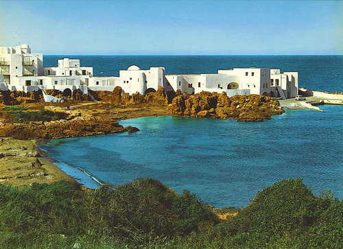
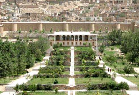
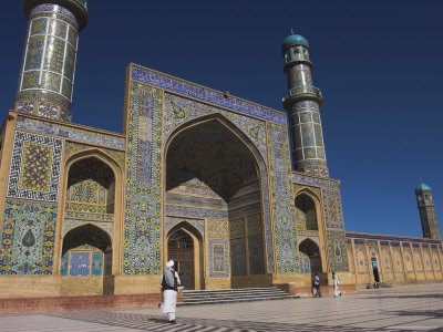
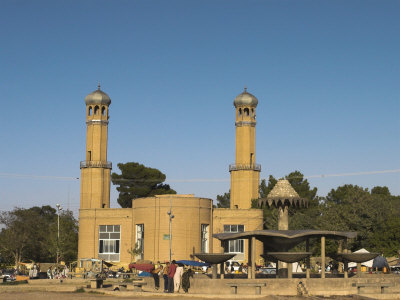
Here Some beautiful Places in Algeria.


Welcome to The Republic of Albania.

Area: 28.748 km².

Location: Southeastern Europe, bordering the Adriatic Sea and Ionian Sea, between Greece in the south and Montenegro and Kosovo to the north

Land boundaries: total: 717 km
border countries: Greece 282 km, Macedonia 151 km, Montenegro 172 km, Kosovo 112 km

Coastline: 427 km

Population: 3,170,048 (January 2008 estimate). Apart from Albanians living in Albania, there are an estimated two million emigrants in the United States, Switzerland, Germany, Greece, Italy, Canada and other countries.

Ethnic groups: Albanian 95%, Greek 3%, other 2% (Vlach, Roma (Gypsy), Serb, Macedonian, Bulgarian) (1989 est.)

Languages: Albanian (official - derived from Tosk dialect), a linguistically a distinct branch of the Indo-European family. First written in 15th century the Albanian language distinguishes two main dialects, Gegerishte spoken in the north and Toskerishte spoken in the south, river Shkumbin being the bordline between the two dialects. Greek is widely spoken in the south of the country, and some state schools there use Greek as the medium of education. Many Albanians speak Italian; some also know English, French or German.

Albanian Counties
Religions: Albania is an extremely secular society. The traditional breakdown is 70% Muslim, 20% Orthodox (the autocephalous Albanian church) and 10% Catholic, but at best these figures indicate nothing more than nominal attachment to each faith. All mosques and churches were closed in 1967 and religious observances prohibited; in November 1990, Albania began allowing private religious practice.

Administrative divisions: 12 counties (alb. qarqe, singular - qark), 36 districts

Capital: Tirana (alb. Tiranë), population 555 848 (January 2008 est.)

Main Cities: Durres (alb. Durrës), Shkodra (alb. Shkodër), Vlora (alb. Vlorë), Elbasan, Korce (alb. Korçë), Berat (alb. Berati), Gjirokastra (alb. Gjirokastër), Saranda (alb. Sarandë)

System of government: Parliamentary democracy.
About Albania:
In the heart of the Mediterranean, on the Adriatic and Ionian Seas, Albania is fast becoming one of the world's most interesting getaways. Still relatively unspoiled by globalization, tourists will notice an inspiring mixture of civilizations and cultures - making this European country truly unique.


Nestled in between Greece, Macedonia, Kosovo, and Montenegro, and across the Adriatic from Italy, Albania boasts blue and turquoise seas, beautiful beaches, snow peaked mountains, rivers, lakes, and forests. As well as stunning nature, Albanians themselves are famous for their hospitality, and tourists are welcomed with heart-warming generosity.


Albanian history and culture is fascinating. Butrint, one of the world's archeological wonders - and a UNESCO World Heritage site - in the south of Albania provides a glimpse of Mediterranean civilization from the Bronze Age through the Greek, Roman, Byzantine, Venetian and Ottoman periods - all atop a cliff overlooking Corfu. It's not to be missed!


Home of both Mother Theresa and the great 15th Century hero Skanderbeg, Albania today offers not only beach and mountain holidays, but also a vibrant city life, a relaxing outdoor cafe culture and you will see that it's quickly evolving in a myriad of directions.


Albanian Hospitality and Culture

Albania is an incredibly hospitable culture and has its own particular traditions of courtesy. They are very closely related to the notion of hospitality, a notion similar to that of the sacred guest from Homer and classical literature. Many Albanian traditions of hospitality come from The Kanun, or "The Code", a 15th-century text written by the powerful Dukagjin clan, although many of the laws written in the code date from earlier times.


As written in The Kanun, the guest will be shown the highest respect by being offered a seat at the head of the table. The guest is then regaled with the best the family has to offer, usually taking the form of homemade raki, traditional liquor.


It is an Albanian tradition to shake hands when meeting one another, and in many cases, they kiss each other on the cheeks, generally four times. One of the most common gesticulation confusions arises from the fact that Albanians nod their heads up and down to mean "no", and shake their heads left to right to indicate "yes". Another specific Albanian gesture that may be confusing to foreigners is when the palm is placed in the chest, it expresses thanks.
Also note that it is unacceptable to exhibit yourself topless in the seaside, or worse, naked; of course, there are many isolated places where you can do this in private.


Albanians are friendly and very open towards foreigners that visit their country. If you are lucky enough to be invited to visit an Albanian's home, you will be treated as royalty. As written in The Kanun, the guest will be shown the highest respect by being offered a seat at the head of the table.


Climate:

Albania has a mild, Mediterranean climate. Many visitors will find that it never gets cold in the lowlands. The Ionian Cost, in particular, is very clement; with aver age winter temperatures of 8-10 °C (46-50F).


In Tirana and in other inland cities on the plains, temperature sometimes drops below freezing, but this is usually only at night, and it is rare for ice or snow to last more than a day.
The country enjoys a good deal of sunny weather, with an average of around 300 sunny days each year. Most of Albania's annual rainfall occurs between late autumn and early spring; outside of the mountainous areas, it is unusual for it to rain in summer.


In the summer, visitors often find the inland towns to be quite hot, with July usually being the warmest month. In Tirana, for example, temperatures occasionally reach 40 °C (104F). Many hotels and restaurants have air conditioning. The best places to be in midsummer are on the coast, where sea breezes keep the average temperatures down to a more tolerable 25-30 °C (73-86F), or in the high mountains.
Natural Heritage:

Adriatic Coast

The Adriatic coast starts in the delta of Buna River by the city of Shkodra. Once upon a time, this was a Dalmatian coast with deep waters and a number of islands. Now it has shallow waters as a result of the delta of the country's largest rivers. A number of fields exist to the south of Buna. The formation of snaking underwater beds has created a number of bays and lagoons. The delta continues to grow every year by several meters. This land expansion is larger in the south in Myzeqe and slower in the north near Lezha.

The artificial irrigation systems build in Durrës in the 1970s quickened the process. This evolution has increased the tourist value of the area with beaches such as: Velipoja, Shengjini, Kune, Gjiri Lalzit, Durresi, Golemi, Mali Robit, Spille, Divjaka, Darezeza and Plazhi i Ri Vlorë.

By the Adriatic coast you will find clean sea waters, high quality service, traditional and modern cuisine, lagoons, lakes and rivers. There are great possibilities for nature lovers, eco-tourists and others. Hunting too can be practiced in the region's rich ecosystem.


Ionian coast

It starts in Uji i Ftohtë (Cold Water) in Vlora and continues with few interruptions all the way to the Cape of Stillo. It has a high abrasive intensity because the sea is deep while river deltas are lacking. As a result, waves on the Ionian can reach up to 4 m while the coastline is rocky. On the coast you will find a number of small bays and comfortable beaches. Some of them are rarely visited due to the difficult access roads which may make your experience all the more intimate.

Some large tectonic bays are: Vlora Bay, Porto Palermo, Saranda Bay etc. Here you can dive, sail, fish etc.

The Albanian Riviera coastline has high temperatures and therefore a subtropical flora. The Riviera is one of the most picturesque places of the Mediterranean with a lot of tourist potential. In the last few years, the number of visitors has increased exponentially.

The presence of lakes, lagoons, rivers, deltas and seas in Albania points towards the development of water tourism. The Mediterranean climate offers ideal conditions for holidays in the deltas as well as elsewhere on the coast. Especially in the south, tourists start visiting the beaches in late April and stop in October.

Moreover, since the coastline has a long history of Greek, Illyrian and Roman settlements, visiting Albania's coast can be a great experience for history buffs.

There are a number of historical facts, cultural and archaeological objects that point to a population that lived here since the Paleolithic era. In medieval times too a number of cities in the coast flourished offering visitors a rich cultural inheritance.


Albanian Flora and Fauna
Due to its diverse climate and pristine landscapes, Albania has a great variety of plants and is home to a number of rare birds and animals that have either disappeared or are disappearing in the region.
The great plane and oak forests are home to wolves and foxes while the higher pine forests house bears, wolves, wild cats and other animals. Deer, wild goats and wild boar can easily be found in a number of regions.


Mountain and Rural Tourism:


Albania has no less than 14 kinds of bats and 350 local birds, some of them migratory. Pine forests are host to rare wild cocks and woodpeckers. In other localities you can find eagles, hawks and falcons. Also, there are several kinds of owls including the bearded owl and the owl with horns.

In Albania visitors can also find a number of different kinds of reptiles such as water snakes, house boas and others. There are 260 kinds of fish—of the Mediterranean type in salty waters and trout in mountain creeks. Lakes have carp, eel and other common types.


Albania also has a rich flora with over 3,221 types of plants.
Among them, 489 are specific to the Balkan Peninsula and 40 are located only in Albania. Oak forests are typical and comprise 20 percent of the forested area of the country. In other areas visitors can find   Mediterranean shrubs up to 800m above sea level and eucalyptus, sea figs and laurels.


Albanian Mountain and Rural Tourism

The territory of Albania has several regions where mountain and rural tourism is well-developed. Among the most important are:

Albanian Alps: Western Alps - Razëm - Bogë - Theth - Vermosh
Razëm
The alpine tour of Albania is not complete without a visit to the Western Alps (Alpet Perëndimore). Here you will enjoy something unique: you will walk, breath, sleep and eat amidst the legends starting from Homer and ending with the modern tales of our days. This tour gives you the chance to enjoy a unique place at the heart of the Albanian Alps, Gropa e Thethit.
Boga
The road will lead you from Razma to the village of Dedaj and then onto Boga, a village surrounded by the Alps and described by Edith Durham in her book The Burden of the Balkans. Boga is the perfect place for mountain climbing, skiing, and spelunking. Among the most famous caves, you can visit the Cave of Mulliri (“Mill”), Akullore (“Ice Cream”), and Njerëzve të lagun (“Wet People”). The Cave of Puci is one of the most attractive, situated at 1,087 m above sea level. It is 5 km long and rich in stalactites, stalagmites, and wall veils. The cave has many levels, five alone in the center. By passing through its galleries you can connect with another cave, the Cave of Husi.
Vermosh
Another interesting spot of the Western Alps is Vermosh, part of the northern-most region of the country. Vermosh is 95 km away from the city of Shkodra. Vermosh is part of the region of Kelmend, a name that originates from the Roman word "Clemens", meaning gentle, simple, and good. The first thing that catches the eye during this journey is Qafa e Rrapshit where you can see the crystal-clear waters of the Cemi River that create a beautiful contrast with the surroundings. During summer, the ponds of the river are perfect for sunbathing.
Llogara (The National Park)
The Llogara National Park lies approximately 40 km south of the city of Vlora. It is situated in the Llogara Mountain and has a surface of 810 hectares, with heights of between 470 and 2018 m above sea level. It combines the beauties of a mountain and seaside climate. You can enjoy part of its magical natural beauty while traveling along the Vlorë-Sarandë National Highway at Qafa e Llogarasë, 1025 m above sea level. Here, medicinal and decorative plants mix with masses of pine trees. The park also is home to many different kinds of animals.
Palasa
After passing Qafa e Llogarasë through a road that dates back to the Pompey period, you descend into the Albanian Riviera. This warm Mediterranean zone has nearly 300 sunny days a year, and the average temperature of July is 25°C (77° Fahrenheit). The list of places to visit begins with the beach of Dhraleo (Palasë) known for its clear waters. Pompey and his army stopped at this beach in ancient times, when it was known as Palestra.
Dhërmi
Dhërmi is famous for its crystal-clear waters, and small, intimate pebble beaches like Jaliksari, Shkambo, and Gjipea. Gjipea is a rare beauty, for it is situated at the foot of a 70 m high cliff. Close to Dhërmi is the legendary Cavern of the Pirates.
Dhërmi is a picturesque village of a particular atmosphere. It is thought to have first been inhabited in 49-48 B.C. In Dhërmi there is the Monastery of Shën Mëria, the Church of Shën Todhri, the Church of the Ipapandia and the Church of Shën Mitri with its frescos from the 12th -14th centuries
Vuno
Eight km south of Dhërmi there is the village of Vuno, well known for its traditions and patriotism. From here, the road goes to the wonderful beach of Jala, whose fantastic gulfs are distinctive from those in the rest of the Riviera. Vuno is a unique village, built on a hill facing the sea. Here you can visit old churches like the Church of Shën Spiridhoni, built in 1778, and the Church of Mesodhia with paintings from 1783. There are also several architectural landmarks such as the ruins of the House of Odise Kasneci and the tower-like House of Shane Kote.Himara
Continuing your tour towards the south, you will come across the small city of Himara, which has two neighborhoods: Old Himara built on the hill, and New Himara in the gulf of Spille. The beaches of Himara are Spille, Llamani, Potami, and Livadhet. They are all gravel beaches with deep, clear waters. Himara comes to life during the summer tourist season, when visitors take up residence in the hotels or in rented houses.
Qeparo
Close to the gulf of Porto Palermo stands the village of Qeparo with its own distinctive beach. Old Qeparo, built on the hillside, has several objects worth seeing, such as the three-story Towers of Ali Pasha, the Monastery of Shën Dhimitri, and the House of Minella Gjika.
National Parks:
Albanian National Parks


Dajti National Park
Located just east of Tirana, the Park covers approximately 3,300 hectares. It is only 50 km from the airport and 26 km from Tirana. The park contains a number of beautiful 200 year old beech trees that are really worth seeing. The Park is frequented by daily visitors and it is considered Tirana's "natural balcony." Accommodation is available for tourists interested in more than day-long stays.

Lura National Park
Spans approximately 1,280 hectares to the east of "Lura's Crown." The most picturesque feature is the 14 glacier lakes of Lura which are frozen in the winter. To the south you can visit the "field of mares" which has a wide variety of colorful plants and coniferous trees. The Park has great potential for developing eco-tourism.

Divjaka Pines National Park
This Park is 40 km east of the city of Lushnja and 5 km from Divjaka. The Park consists of 1,250 hectares and contains part of the Karavasta Lagoon which has been under the protection of Ramsar International Convention since 1994. The Park area contains one of the most important ecosystems in the country. The Park is rich in exotic fauna such as eel and is also home to 5% of the global population of the threatened Dalmatian Pelican.

Llogara Park
Located about 40 km southeast of Vlora, this Park marks where the Adriatic and Ionian Seas meet. Near the Llogara Pass, a cut in the mountains along the national road, thanks to strong wind currents one can observe a number of interesting tree shapes, just ask for the "Pisha Flamur" (The Flag Pine) who’s shape reselbes that of the eagle on the Albanian Flag.
From the Llogara Pass, visitors can hike to see the Ionian Sea, the steep slopes of the Vetëtima (Lightning) mountain and a good part of the Albanian Riviera. It is a great spot to enjoy the mixed mountain and sea micro-climate as well as a excellent place for air sports.

Fir of Drenova National Park
Located 10 km from the city of Korca, the park has an area of 1,380 hectares. It is visited frequently by locals as well as tourists. Many locally famous drinking water sources such as Shen Gjergji, Plaka, Pllica and others are located in the Park.

Valbona Valley National Park
With an area of 8,000 hectares this Park is considered the gem of Albanian Alps. It is located 25-30 km to the northwest of the town of Bajram Curri. It lies between high mountain peaks and it is a festival of colors and contrasts as well being rich in biodiversity. Valbona village is the focal point of the Park. Its configuration, hydrology, forests, flowers, rustic dwellings and the hospitality of its people make this park an ideal place to visit.

Tomorri Mountain Park
With an area of 4,000 hectares, the Park is to the east of the museum city of Berat. From afar, the mountain of Tomorr gives the impression of a gigantic natural fortress. Here is also the grave of Abaz Aliu (Tyrba e Kulmakut), 1,200 m above sea level. Every year, during the third or fourth week in August thousands of pilgrims go up to the holy site of Tyrba for a week of celebration of a traditional Bektashi festival.

Fir of Hotova National Park
With an area of 1,200 hectares in the region of Frashër, it is located about 35 km northeast of Përmet. The Park takes its name from the Hotova Fir which is considered one of the most important Mediterranean plant relics of the country. Thanks to its beautiful natural surroundings, healthy climate and proximity to living quarters, this Park has great recreational value year round.

Shtam Pass National Park
With an area of 2,000 hectares, the Park is 25 km northeast of Kruja. The water source "Queen Mother" is one of the most attractive spots in the Park with clean, cold and curative waters. The Park is frequented by a large number of visitors.

Zall Gjocaj National Park
Covers 140 hectares 40 km north east of the town of Burrel. It is a very picturesque park with numerous underground water sources and creeks.

Prespa National Park
Covers approximately 27,750 hectares and straddles the borders of Albania, Greece and Macedonia. It contains the lakes of Big Prespa (Prespa e Madhe) and Little Prespa (Prespa e Vogël) and their water source. It is an area rich with cultural tradition. Eremite Byzantine churches exist by the cave of Tren, Prespa e Vogël Lake, Trajani's castle, St. Mary's Church and on the island of Maligrad. The two lakes have now become the Balkan Prespa Park.

Butrint National Park
This Park is located about 25 km south of the city of Saranda. It has high scientific, tourist and archaeological value as well as rich in biodiversity. The park is 2,500 hectares. The Park and surrounding region offer entertainment for all types of tourism beaches in Ksamil, ecotourism in Butrint Lake, fishing, hiking , water sports and more.
Tourist Services:

Here are Tourist Services:
Accommodation
Business and Conference Facilities
Transportation
Travel Agencies.

Welcome to AFGHANISTAN.


Geography
Afghanistan, approximately the size of Texas, is bordered on the north by Turkmenistan, Uzbekistan, and Tajikistan, on the extreme northeast by China, on the east and south by Pakistan, and by Iran on the west. The country is split east to west by the Hindu Kush mountain range, rising in the east to heights of 24,000 ft (7,315 m). With the exception of the southwest, most of the country is covered by high snow-capped mountains and is traversed by deep valleys

Government
In June 2002 a multiparty republic replaced an interim government that had been established in Dec. 2001, following the fall of the Islamic Taliban government.

History
Darius I and Alexander the Great were the first to use Afghanistan as the gateway to India. Islamic conquerors arrived in the 7th century, and Genghis Khan and Tamerlane followed in the 13th and 14th centuries.

In the 19th century, Afghanistan became a battleground in the rivalry between imperial Britain and czarist Russia for control of Central Asia. Three Anglo-Afghan wars (1839–1842, 1878–1880, and 1919) ended inconclusively. In 1893 Britain established an unofficial border, the Durand Line, separating Afghanistan from British India, and London granted full independence in 1919. Emir Amanullah founded an Afghan monarchy in 1926.
President: Hamid Karzai (2002)

Total area: 250,000 sq mi (647,500 sq km)
Population (2010est.): 29,121,286 (growth rate: 2.4%); birth rate: 38.11/1000; infant mortality rate: 151.5/1000; life expectancy: 44.6; density per sq mi: 128\
Capital and largest city (2003 est.): Kabul, 2,206,300

Other large cities: Kandahar, 349,300; Mazar-i-Sharif, 246,900; Charikar, 202,600; Herat, 171,500

Monetary unit: Afghani
KABUL


The capital of war torn Afghanistan is one of the oldest cities in Central Asia. Kabul is situated on the Kabul River and is one of the highest capital cities (1800 m - above sea level) in the world. The history of Kabul dates back to the legendary times of epic Ramayana when Kubha is mentioned as the founder of the city. Lying at the crossroads Kabul was always victim of invasions and civil strife. During the reign of Kushanas the city must have been a place of importance since it led the way to their winter capital of Peshawar. In the vicinity of Kabul was the famous Begram, which had attained its prominence of being an important center of the eastern Hellenic Art. Kabul rose to importance when Mughal Emperor Babur made his capital and since then it inter-acted with various ruling dynasties. The recent history of Kabul is painful being subjected to incessant civil war and lately under the wrathful rule of clerics.

The Nation’s chief economic and cultural center, it has long been of strategic importance because of its proximity to the Khyber Pass. This city grew as an industrial center after 1940 and the main products of this city were textiles, processed food, chemicals and wood products, Tajiks are the predominant population group of Kabul and Pashtuns are an important minority. Kabul University, which is now partially opened, was founded in 1932 and during 70’s and 80’s it was the best known in the region for higher education.

Kabul was occupied by Soviet troops in 1979 and later it went through the toughest and most disastrous civil war of its history from 1992 to 1996. Taliban later ruled the city from 1996 to 2001 before the Northern Alliance took over the city as Taliban withdrew from Kabul after the American intervention in Oct 2001. Currently, Kabul is the capital of Transitional Government being led by Mr. Hamed Karzai.

The city of Kabul, which used to be a tourist attraction, has lost its charm during the last 24 years of its history. Infrastructures such as roads and traffic system, telephone and electricity system, water sanitation, renovation of buildings is in shambles and the need for reconstruction is very much needed to bring back the city to a better place for living. The major places of interest in Kabul are as follows:
KABUL BALA HISAR:
The Bala-Hisar means a citadel or fortress within a walled town on top of a ridge or hill. Bala-Hissar as town’s main defensive complex has served as residence of Afghan rulers. Most of Afghan historic cities have a Bala-Hissar. The famous emperors like Babor Shah and Timor Lang are said to have resided in it. This 06th century old fortress has witnessed most of the exciting events of the century’s history until 1880 when it was destroyed during the second Anglo Afghan war. Nadir Shah started the process of reconstruction and since 1939 it served as military college until it was left in ruin by the bombardments & skirmishes.
KABUL MUSEUM:


The Kabul Museum, which used to have one of the finest collections of antiquities in Asia, has had nearly three-quarters of its finest collections looted. It is still possible to see the remaining artifacts - those without any significant monetary value. Museum hours are erratic.
GARDENS OF BABUR:

ARG (Palace):


Amir Abdul Rahman (1880-1901) built this citadel to operate the Bala Hisar places. Within the Arg, there was Salam khana (hall of salutation) and the Dilkosha Palace (Heart Delight palace). Later it was used for presidential offices until it was left in ruin due to heavy bombardments.
The pleasant Gardens of Babur were once a cool retreat near the city walls. Moghul Emperor Babur laid out these gardens in 16th century and later Amir Abdul Rehman made few additions and later Emperor Shah Jehan built a mosque. Babur died in Agra in 1530 but he loved these gardens so much that he wished before his death to be buried in these gardens. His Afghan wife, Bibi Mobarka, who built his tomb in these gardens, fulfilled his wish. Recently these gardens were in ruin but now AKDN (Aga Khan Development Network) has taken the responsibility of its re-construction to return back to its past glory.
MAUSOLEUMS:
BAZAARS:
Kabul’s many colorful bazaars were the places to attract a large number of visitors for shopping and sightseeing. Among the most famous, which exists in today’s Kabul as well are Chicken Street, Shor Bazaar and Bazaar-e-Charchata.
MOSQUES:
Since Afghanistan is an intensely Muslim country and for centuries the Muslim rulers have ruled it, therefore, the rich Islamic heritage can be seen in architecture of many interesting mosques. The most famous ones in the center of the city are:

Masjid-e-Pule Kheshti, Masjid-e-Shahe Du Shamshira, Masjid-e-Sherpur (Blue Mosque), Masjid-e-Id Gah, Masjid-e-Syed Majnun Shah & Masjid-e-Wazir Akbar Khan.

HERAT


Herat was one of the largest cultural and Islamic centers in the Central Asia in 14th through 16th centuries. Herat is the third large city in Afghanistan with 150,000 population in 1992. It is located in the western part of Afghanistan bordered with Iran and custom port of Islam Quala connect the 02 countries; Afghanistan & Iran. Herat is the center of the same name of Herat Province.

Herat was once a small, provincial, relatively green, laze-about place that everyone seemed to like, an easygoing oasis after a lot of hassle and dry desert. In the 15th century, Herat was the Timurid center of art, poetry, miniature painting & music, blending Persian, Central Asian and Afghan cultures to create one of Central Asia’s cultural highlights.

From the first half of 15th century to the beginning of 16th century, Herat intensively grew by territorial size and population. Particularly, by the time of Ali Shir Nawahee, this city developed not only as capital, i.e., largest center of handicraft productions and trade, but also as outstanding artistic and cultural center of Central Asia. Similar to the city of Herat had not been neither in all Middle East region, nor in Central Asia.

The economy of Herat is based on agriculture, the planting of cotton, rice, and wheat. Home industries produce rugs, carpets, silk materials, fur jackets and products of camel hair. Herati rugs have a worldwide value. The economic and agricultural activities in Herat have concentrated in the valleys of Hari Rod River. Herat historically has a great historic and tourist value. The traditional buildings and mosques, which form the dominant architectural accent of city, have played a significant role to attract mass of population and tourists to this historic city, which is 645 km west of Kabul.

The tomb of Timur Shah, son of Ahmad Shah Durrani, who moved the capital from Kandahar to Kabul, was built in 1817. A charming landmark of the city is the mausoleum of Amir Abdul Rahman, one of the Afghanistan’s most rulers. It stands in Zarnegar Park, in the center of the city as a fine example of 19th century architecture remaining in Kabul. The imposing white-marbled, blue-domed mausoleum of Nadir Shah stands on the hill known as Tapa Marajan overlooking Kabul.
The places of interest in Herat are as follows:
MASJET-E-JAM:


The Friday Mosque or Masjet-e-Jam is Herat number one attraction and among the finest Islamic buildings in the world, certainly the finest in Afghanistan. “Masjet-e-Jam” is the largest building in this region and is known for its beautiful tile and mosaic decoration. Ghorid Sultan Ghiyas-ud-din originally laid out the form in which it stands today on the site of an earlier 10th century mosque in year 1200. The mosque is an exciting example of the artistic sophistication of the Ghorid. The various artworks in this mosque also provide the visitors an opportunity to compare the Ghorid and Timurid tiles work. The restoration work on this mosque started in 1943 as an effort to return it back to its past glory. Besides the artwork, other attractions in this mosque are the huge bronze cauldron, which used as a receptacle for Sherbet (a sweet drink) but now a day it is used for collection of donations, the unadorned tomb of Sultan Ghiyas-ud-din, and a tall pillar in the garden that was erected to commemorates Afghanistan’s fallen soldiers.
THE CITADEL (Qala-i-Ikhtiyar-ud-din)


Built in its present form by Malik Fakhruddin in 1305 A.D., this citadel has a long & stormy history as conquerors like Genghis Khan and Tamerlane fought beneath its walls. This fort, originally built by Alexander the Great, suffered repeated attacks over the history but still dominated the landscape of Heart. Held by the Ghaznavids, the Seljuks, the Ghorids, the Mongols, the Timurids, the Safavids and others, the citadel is a reminder of the time of Kings, conquerors and great pageantry.
MOUSALLAH COMPLEX:


On a short walk from the city center are the remains of old madrassa built by the Queen Gaur Shad in 1417. The wife of Timurid ruler Shah Rukh, Gaur Shad was the daughter-in-law of Timur and a remarkable woman in her own right who kept the empire intact for many years. The Mousallah Complex has been described as the most beautiful example in color in architecture ever devised by man to the glory of his God and himself. Gaur Shad’s mausoleum still stands near the madrassa. There were 12 minarets in this complex but six of them were demolished by British troops in 1885 whereas earthquakes subsequently downed rest of the three in 1931 & 1951. The mausoleum of Gaur Shad still stands near the madrassa. This is a beautiful tomb with tile work and typical ribbed dome as of Tamerlane in Samarkand.
TOMB OF THE POET JAMI:


The other attraction in Herat is the tomb of famous 15th century Persian poet, Nur-ud-din Abdurrakhman Jami, who died in 1492. Jami was the greatest of the 15th century’s poets, a titan during a period characterized by supreme literary brilliance. His simple tomb sheltered by a spreading pistachio tree, lies in the garden of a mosque.
GAZAR GAH:
The shrine complex of Gazar Gah (1425) is about 5 km east of Heart. Here Shah Rukh built many buildings, which were lavishly decorated with brilliant tile work. The main attraction is the tomb of Khawaja Abdullah Ansar, a famous Sufi mystic & poet who dies in 11th century. Crouching in front of the shrine’s main portal, its nose resting lightly on its paws, there is a white marble statue of an animal, variously thought to be a lion or a dog. Next to him is the tomb of Amir Dost Mohammad, one of the former kings of Afghanistan. The other main attractions in Gazar Gah are Main iwan (main court), a fifteen-foot marble pillar depicting the artwork of Timurid period. A remarkable sarcophagus called Haft Qalam (seven pens) fashioned of black marble, Khana Zarnegar (Pavilion adorned with gold) and Hauze Zamzam (Sacred water pond) are the other attractions.
CHAHRSUQ:
Herat bazaars are full of fascination and colour. As in most large towns in Afghanistan, the four main bazaars of the old city come together at a central square called the Chahrsuq or Four Bazaars. This is the hub of the old city and in addition to the shops lining the streets there are several covered bazaars in the vicinity. Another monument of architectural interest situated within this bazaar is a large covered reservoir of 1634, which was used to distribute water in the city during the Safavid’s period.
CHISHT-I-SHARIF: Chisht-i-Sharif is some 177 km from Herat city. It is a scant but as you approach it across a plateau, you can see the 02 famous gumbad or domes of Chisht. The town with its meandering bazaar street sits in the ravine between these plateaus. Winding down & up, you will find an avenue of pine trees leading directly to 02 ruined buildings now standing in the middle of an extensive graveyard. Experts argue as to the purpose of these buildings. Some speak of them as mausoleums. Others see them as parts of a grand complex of buildings, a madrassa, perhaps with its mosque. The mutilated molded terracotta brick decoration can only speak softly their former magnificence. Stylistically, the decoration of these buildings falls into the category of Ghorid arch in the Masjet-e-Jami and the minaret of Jam, both of which bear the name of Ghiyas-ud-din Ghori (1157-1202).
BAMIYAN


Bamiyan is a province in Central Afghanistan with an area of about 6700 sq.m and a population of about 280,00 in 1992. A town of the same name is the administrative center of this province. Bamiyan is counted one of the poorest regions of Afghanistan because of its geographic location and its isolation from other regions.

The village of Bamiyan with its archeological remains is the most conspicuous site of Afghanistan. The village lies about 2500m above sea level and some 240 km west of Kabul. The exquisite beauty of this valley is embraced by the snow-capped Range of Koh-e-Baba Mountains in the south and in the north by the steep cliffs in which images of Buddhas were carved. The pastel colors of its surroundings give visitors an impression of the magnificence and serenity of nature.

The area of Bamiyan developed under Kanishka the Great to become a major commercial and religious center and smaller statue of Buddha (38 m high) was built during his reign. Two centuries later the colossal Buddha statue (55 m high) was curved. Thousands of ornamented caves, inhabited by yellow robed monks, extended into Folladi Pilgrims from the entire Buddhist world poured into Bamiyan to admire its spectacular and sacred sites.

The town was rules in 07th century by princess but was subject to the Western Turks. The rulers first accepted Islam in the 08th century. Bamiyan fell to Muslim conquerors when the Saffavid ruler captured Bamiyan in 871. After changing hands several times, Bamiyan was destroyed and its inhabitants exterminated in 1221 by the Genghis Khan. Since that time it has never regained its former glory. In 1840 Bamiyan was the scene of fighting in the First Anglo-Afghan War. A significant number of tourists from all around the world were visiting this site before the Civil War in Afghanistan. Besides the Buddha caves there are various other sites as well in this area including Shahr-e-Gholghola and Shahr-e-Zohak.
BOT-E-BAMIYAN (Buddhas Statue):
The 02 famous Buddha statues (36 m & 53 m high) dating from 03rd & 5th century were located in Bamiyan province. These statues were hewn into solid rock and overlaid with stucco, and although they have suffered from the ravages of time and destruction by man, some of the stucco works and wall paintings are still preserved. The walls of the 90m high cliffs are honeycombed with caves that used to serve as living quarters of Buddhist monks. The sculptures and paintings are “an eclectic hybrid mixing Indian, Central Asia,

Iranian, and classical European styles and ideas. The caves were of various forms and the interiors of many bear traces of fine fresco painting that links them with contemporary caves in Sinkiang, China.

These statues were first mentioned in 5th century A.D. when these statues were visited by Chinese traveler Hsuan-Tsang in 630 A.D. At that time Bamiyan was a center of commerce and the Buddhist religion. When Hsuan-Tsang saw these statues, they were decorated with gold and fine jewels. The 02 Buddha figures, together with numerous ancient man-made caves in the cliffs north of town, made Bamiyan a major Afghan archaeological site. Taliban officials destroyed these statues in 2001. Clerics interpreted Islamic law to mean that such artifacts were disrespectful to Allah, though the world (including the governments of Iran and Saudi Arabia) begged them to reconsider. Now little remains of these shrines are left. The modern town of Bamiyan lies below the caves.
BANDE AMIR LAKES:
It is the unspoiled natural beauty of Afghanistan that forms the visitor’s first and most enduing impression of the country. But of the entire natural wonders of Afghanistan, the lakes of Bande Amir are perhaps the most outstanding. Situated in the mountainous Hazarajat at an altitude of approx 300m, 75 km from Bamiyan, these majestic blue lakes are of legendary beauty.

A series of five clear blue lakes is formed by the flow of water over a succession of natural dams, running from higher to the next one below. According to local tradition, the dams were the creation of Hazrat Ali (Caliph Ali), and the word “Amir” (King or Commander) refers to the Caliph, not to any Afghan ruler. Bande Amir is also the name of a river which rises in the Bande Amir lakes and runs through Yakowlang valley in a southwest direction until it turns northeast, at that point it is known as the Balkab, finally it turns north and dissipates in the Turkestan plains.
SHAHR-E-GHOLGOLA (Town of noise):
The cave town of Shahr-e-Gholgola is located in central part of Afghanistan. These are the ruins of a once prosperous city of 05th to 07th A.D., which was demolished by Genghis Khan during his invasion in Bamiyan Valley in 1221 A.D. The name is derived from Persian and means the “city of noise”. Others refer to it as “Silent city” or “Screaming city”. The Mongols themselves have called this city “Mao Balegh”, meaning the “Cursed city”. Infact when Genghis Khan brought the defenders of this town to their knees where upon he entered the citadel to fulfill a vow to kill everybody including man, woman, child, bird and animal in the valley. The scream that accompanied the final massacre gave the citadel the name by which it is known today.
SHAHR-E-ZOHAK (Red Town):
This is another cave town located just near to Shahr-e-Gholgola. This city is built on a steep spur just 15 km east of Bamiyan. These ruins are situated a top 350 ft cliffs of red colour overlooking the Valley of Tagao, Bamiyan. Due to these red colour cliffs, this city is known as “Red Town”. The ruins of this town represent the Buddhism era of 05th to 07th century A.D. This mass of impressive ruins was once the principal fortress protecting the entrance of the city of Bamiyan during the reign of the Shansabani King in 12-13th centuries A.D. Genghis Khan destroyed this town in 1221 A.D. as revenge to his wounded grandson.
BALKH


The town of Balkh, which is the same name of the province, has a very glorious past. It is located in northern Afghanistan close to Mazar-i-Sharif. It is claimed to be one of the world’s oldest cities and the legendary birthplace of the prophet Zoroaster. Alexander the Great reputedly founded a Greek colony here. The city later attained great wealth and importance as Bactria, capital of the independent kingdom of Bactria. In the early centuries A.D., Balkh, a prominent center of Buddhism, was renowned for its Buddhist monasteries and stupas.

The Arabs came in the 08th century and made it an important center and especially it became important in the world of Islam as the original home of the Barmakids. Under the Abbasids caliphate its fame as a center of learning earned Balkh the title “mother of cities”. By the 09th century, during the rule of the Samanid Dynasty, about 40 Friday mosques stood within the city.

Balkh is also known as the home of Rabia Balkhi, the first woman poet of Islam period and of Mauwlana Jalal-ud-din Balkhi (Rumi), perhaps the most distinguished Sufi poet. His Masnawi is considered as the greatest poem ever written in Persian language. Balkh’s glorious history closed in 1220 A.D. when the mounted men of Genghis Khan rode through and left in utterly devastated. The city, nevertheless, lying on an important trade route recovered under the enlightened rule of Shah Rukh and his Queen Gawhar Shad of Heart

In 1850, Balkh became part of the unified kingdom of Afghanistan. The old city is now mostly in ruins; the new city, some distance away, is an agricultural and commercial center, inhabited chiefly by Uzbeks. Excavations have uncovered objects of the early Muslim period.
MAZAR-I-SHARIF:
Mazar-i-Sharif means “The Noble Grave” is one of the most prestigious and religious cities in Afghanistan that is located in northern part of the country. Based on the historical facts and local suggestions; the tomb of Hazrat Ali (Caliph Ali), cousin and son-in-law of Holy Prophet Muhammad (PBUH) is located in this city. Each year thousands of people come to this city to attend the New Year celebration of Nowroz and visit the grandiose Mosque of Roza Mubarik.

The main ethnic group of population of Mazar-i-Sharif is Uzbeks who form around 9% of Afghan population. It is the capital town of Balkh province and a major trading center famous for Karakul, a great variety of traditional Turkmen carpets and high quality, long staple cotton.
ROZA MUBARIK (Shrine of Hazrat Ali):
The magnificent shrine of Hazrat Ali is the main attraction in the city of Mazar-i-Sharif, which also derive its name from the same shrine. The 04th Caliph of Islam, Hazart Ali was assassinated in 661 A.D. and buried at Kufa near Baghdad. Local tradition, however, relates that his flowers, fearing enemies may take revenge on the body, placed his remains on a white she-camel that wandered until she fell exhausted. On this spot the body was buried. All knowledge of the final resting place was lost until its existence was revealed and the great Seljuk Sultan Sanjar ordered a shrine built here in 1136 A.D. Genghis Khan destroyed this building and again the grave lay unmarked until a second revelation during the reign of Timurid Sultan Hussain Baiqara. He ordered an elaborate shrine constructed in 1481 A.D. None of the 15th century decoration remains but modern restoration has returned the building to its original beauty. This shrine is one of the famous Islamic architecture styles. Tow cupolas were constructed over the tomb by Sultan Ali Mirza of Timurids dynasty of Herat in early 15th century.

Roza Mubarik is visited by countless pilgrims throughout the year and particularly on Nawroz (21 March) when the great Janda (religious banner) is raised to announce the beginning of spring and the coming of the New Year, which is the most elaborately celebrated festival in Afghanistan.
NO-GONBAD MOSQUE (Mosque of Nine Cupolas):
This mosque is located 12 km south of small town of Balkh and was built in 09th century. The mosque is not large being only 10 sq.m. Nine cupolas originally covered it but the domes have fallen and the floor is now buried under more than a meter of rubble. This mosque is also known as Khoja Piada. Some researchers suggested that this mosque witnessed of transition to the new step of development of local constructed art, which neither had known in the West, nor in the East before. Based on the latest archaeological excavation, the ruins of this complex date back to 08th & 09th century.
TOP-I-RUSTAM & TAKHT-I-RUSTAM:
02 mounds standing by the south shoulder of the paved road to Balkh are the remains of the monastery and stupa described by Hsuan-Tsang. A 61m high stupa sat a top the eastern mound, today called Top-i-Rustam. The western mound is known as Takht-i-Rustam and was covered by a convent housing several sacred relics of the Buddha. They have long been abandoned forever by the time. Now a days villager takes bricks from these mounds for their own buildings. There are more than hundred Buddhist monasteries in Balkh town.


KANDAHAR


Kandahar, the birthplace and first capital of modern Afghanistan, founded by Ahmed Shah Durrani in 1747, is today the second largest city of Afghanistan located on the Asian Highway halfway between Kabul & Heart. The area is rich in ancient history. Here Alexander the Great founded Alexandria of Arachosia and the region was repeatedly fought over by the Saffavids and Moghuls. It was independent minded Afghan of Kandahar, first under the leadership of Mir Wais and then of Ahmad Shah Durrani, who hastened the decline of both empires and annexed much of their territories to the young Afghan Kingdom in 18th century.

The city of Kandahar is also the capital of Kandahar province and has population of about 250,000. Kandahar is a market for sheep, wool, cotton, food grains, fresh & dried fruit, and tobacco. It has an international airport and is linked by road with Kabul, Herat

Quetta and the Central Asian republics. Woolen cloth, felt, and silk are manufactured. The surrounding irrigated region produces fine fruits, especially grapes, and the city has plant for canning, drying and packing fruits. Modern Kandahar adjoins the old city. Together with Peshawar, Kandahar is the principal city of the Pashtun people. Now a days Kandahar does not see a lot of tourists.
MAUSOLEUM OF AHMED SHAH DURRANI:
Ahmed Shah Durrani, the founder of Sadozy Dynasty has ruled Afghanistan from 1747 to 1772 A.D. In October 1747, an assembly of Pashtun chiefs elected him King of Afghanistan. The Pashtun tribesmen rallied to his banner, and Ahmed Shah led them on nine campaigns into Indian in search of booty and territorial conquest. He added Kashmir, Sindh and Western Punjab to his domains and founded an empire that extended from Eastern Persia to Northern India and from Amu Darya to the Indian Ocean. Ahmad Shah appointed his son Timur as his successor and died of a natural death in April 1772. His mausoleum is known to be an important historical monument in Kandahar and an example pf artwork.
DA SHAHIDANU CHOWK (Martyrs Square):
A monument to pious Martys (Shahidan: those who died in battle) stands in the center of Kandahar’s main square called Da Shahidanu Chowk. Flags and small cannon encircle this monument built between 1946 & 1948.
DA KHERQA SHARIF ZIARAT:
The shrine of the cloak of the Holy Prophet Muhammad (PBUH) adjoins Ahmed Shah Durrani’s Mausoleum. This is one of the holiest shrines in Afghanistan. Ahmed Shah received the Prophet’s Cloak from Murad Beg, Amir of Bukhara, in 1768, as a part of treaty settling the northern boundaries. The building housing this relic is architecturally unpretentious but its sparkling tile decoration commands attention. The door of this shrine is inlaid with Lapis Lazuli, Shah Maqsudi travertine, and chased silver inlaid with gold was installed in 1974. It is not possible to view the relic.
ARG (Citadel):
The Arg or citadel is said to have been built during the early years of 19th century by Prince Kamra, son of Shah Mahmood (1800-1803; 1809-1818) while his father was governor at Kandahar. The offices of the Governor are still located here but only a small portion of the original layout remains.
CHAR SUQ (Four Bazaars):
Ahmed Shah laid out the city of Kandahar with amazing regularity. The four principal bazaars meet in the center of the city at the Char Suq, a square once covered with a lofty dome where public proclamations were made. It is still the hub of the city.
SHRINE OF HAZRAT JI BABA:
Just to the north of city, there is a charming shrine dedicated to a celebrated saint who lived in Kandahar more than 300 years ago. His grave is 23 ft long to signify his greatness but solely covered by rock chips. The graves of Kandahari rulers of 19th century lie near the saint’s tomb.
CHIHLZINA (Forty Steps):
It is about 04 km away from Kandahar on Herat road. The Chihlzina is a rock-cut chamber high above the plain at the end of rugged chain of mountains forming the western defense of Kandahar’s old city. The construction of this chamber was started in 1522 on the order of Moghul Emperor Babur and completed in 1531 A.D. Inside the chamber is the history of domain of Emperors. Forty Steps, about, lead to the chamber, which is guarded by 02-chained lions, defaced and inscribed with an account of Moghuls conquest.
MAUSOLEUM OF MIR WAIS BABA:
It is situated some 10 km from Kandahar city. Mir Wais Hotak was the Ghilzai chief who declared Kandahar’s independence from the Persia in 1709. His mausoleum was built during the reign of Nadir Shah (1929-33). Before this new mausoleum, his tomb had no covering. This building is modeled after the mausoleums of Ahmed Shah Durrani, though it is smaller and has no interior decoration.
BABA WALI:
The shrine of Baba Wali, the spiritual confident of Shah Rukh Mirza of Herat (1405-1447), is situated about 08 km in north of Kandahar. The charming shrine of Baba Wali is situated on the hillside with its terraces shaded by pomegranate groves besides the Arghandab River. A famous landmark in Kandahar known as Fil Koh or Elephant Mountain can also be noted on returning to Kandahar by the way of Baba Wali Pass.
GHAZNI


It lies beside the Ghazni River on a high plateau at an elevation of 2,225 meter. Afghanistan’s only remaining walled town, it is dominated by a 45 meter high citadel built in the 13th century. Around the nearby village of Rowzeh-e-Sultan, on the old road to Kabul, are the ruins of ancient Ghazna, including 43-meter towers and tomb of Mahmood of Ghazna (971-1030), the most powerful Sultan of Ghaznavid Dynasty.

The city of Ghazni is also the capital of Ghazni province with a population of about 35,900 on the Lora Road. It is a 07th century town but it got importance under the rule of Ghaznavid when Mahmood of Ghazna made it the capital of first Muslim Dynasty in Afghanistan. Later Ghorids ruled it before it was captured by Genghis Khan in 1221 A.D. In 14th century A.D. it went to Tamerlane and finally to Mughal Emperor Babur. In 1747, under Ahmed Shah Durrani, Ghazni became part of the new Afghan Kingdom.

The modern town of Ghazni is just a pale shadow if its former glory. Today it is known mainly for its fine bazaars featuring goods from Afghanistan and neighboring countries. The walled, old city of Ghazni with its numerous bazaars contains the ruins of ancient

Ghazni. Ghazni is now a chief commercial and industrial center of Afghanistan, dealing in livestock, furs, silk, and agricultural products. The famed Afghan sheepskin coats are also made in the city.
THE CITADEL:
One of the most imposing fortresses to be seen in Afghanistan, destroyed during First Anglo Afghan War, rebuilt, however, but never to its previous splendeour. The old city of Ghazni, once clustered closely around the foot of citadel but the new town leaves it on the fringes looking forgotten and somewhat forlorn. In addition most of the interior is in ruin today. It is still used as a military garrison, however, and is, therefore, not open to public.
PALACE OF SULTAN MASOOD:
This palace was completed in 112 A.D. and it used to be the court of Masud III who was born in Ghazni in 1061. He ruled from 1099 to 1114 A.D. This palace is a vast complex including a throne room, government offices, soldiers’ quarters, a mosque with its minarets and pockets of gardens in addition to the royal apartment.
THE MINARETS:
The 02 remaining minarets built by Sultan Masud III (1099-1114) and Bahram Shah (1118-1152) now only a fraction of their original height, served as models for the spectacular tower of Jam, which is in turn inspired the Qutab Minaret at Delhi. The intricate decoration is in raised brick without colour and includes epigraphic friezes in square Kufic and Noshki script, in addition to panels of floral and geometric designs. Mounds of ruins at the foot of both minarets indicate that they were a part of 02 large buildings. Evidence from these mounds supports the theory that these buildings were mosques.
MAUSOLEUM OF SULTAN MAHMOOD:
His tomb sits in the center of a garden suburb known during the heyday of Ghazni’s prominence as Bahg-i-Firuzi, the Victory Garden. This garden was a favourite retreat of great Sultan Mahmood and he personally selected it for his final resting place. The tombstone is exquisitely carved of Afghan marble and there one can also note water gushing forth from the mouth of marble lions and rams carved for the same purpose so many years ago.
MUSEUM OF ISLAMIC ART:
This excellent small museum opened in 1966, is in the restored Mausoleum of Sultan Abdul Razaq, a superb example of 16th century Timurid architecture. This museum has a great collection of objects from Ghaznavid period such as ceramic tiles, glass and bronzes. One especially interesting motif found in Ghaznavid art and well represented by museum’s collection is the profuse use of human and animal formation, which is foreign to Islamic art in general. The influence of Sasanian Iran & Central Asia is here beautifully presented.
TAPA SARDAR STUPA:
Tapa Sardar, the prince’s mound acquired its name when Amir Habibullah chose it for a camp side. During his time the top of the hill was leveled, destroying all but the 1st & 2nd sections of an ancient Buddhist stupa. Exploratory excavation carried on at Tapa Sardar from 1959 to 1962 identified a stupa complex.

The central focus of the complex is a towering central stupa 22 meters square making it the largest yet found in Afghanistan. Interestingly, the archaeologists have determined that the enlarged lower portions of the Main Stupa are more recent than the upper sections indicating that this religious complex enjoyed an intensely active life over a long period. The last artistic flourish occurred in fact as late as the 07th & 08th centuries A.D. at a time when Buddhism had largely disappeared from other parts of the Afghan area. The findings at Tapa Sardar confirm definite connections between the late decorative styles of Afghanistan with the art of Central Asia.
LASHKARGAH (Town of Bost)


The town of Lashkargah is located in southwest part of Afghanistan. It is the capital of Helmand Province with about 2600 population in 1992 and also the site of an ancient town built by Sultan Mahmood Ghaznawi in the 10th century.

Lashkargah is located on the Helmand River, a few kilometers. The Ghourids dynasty built this town in 1150 A.D. but it was badly destroyed by Genghis Khan in 1220 A.D. Because of its strategic location, Afghan rulers constructed a number of forts on the site, which was in ancient time known as Bost.

A visitor to the area at the turn of the century observed the fortified plateau “covered thickly with the remains of towers, forts, and palatial buildings, which exhibit traces of on this site of a large and important city, fortified with unusual skill and military are with considerable taste and culture”.

Today the remains of the great palace of Masoud still give the visitor an idea of the splendour of the court of what was then the greatest Empire of the East. The most remarkable monument is the magnificently decorated arch, which has a span of 80 feet and is known as Darwaza-e-Bost (Door of Bost).
This town was also called Lashkari Bazaar by the local population as well as Kala-e-Bost (Fort of Bost).
In the last Some Beautiful Pictures from Aghanistan.